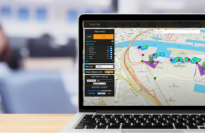
Once our tech team have set up your data points visualising and analysing your data network is as easy as clicking, toggling and choosing visualisation types.
unlimited user logins
Our pricing is based on the number of data points you stream to Active Maps not the number of users. You can let as many people view and access the data as you like.
accessible on any device
As a cloud native solution you can login to Active Maps on the go, viewing your data in the field or at your desk.
inspire collaboration
The simplicity of Active Maps allows you to create different dashboards for different data sets, create a narrative for your data that inspires and empowers.
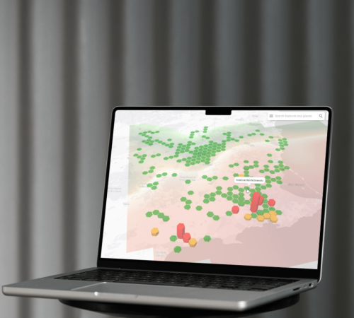
harness the power of accessible gis data
When understanding your data in locational context matters Active Maps delivers. Removing the mystery around GIS data management we're opening the floor to everyone - anyone can visualise, analyse and share their geo-spatial data. Empowering your team to use a tool like Active Maps can lead to quicker action on data changes. A more collaborative approach to your data insights fosters a greater understanding of business problems and therefore a better, more inclusive channel in which to develop the best solutions.
our clients
Dr Peter D. Hunter
Forth-ERA Science Director & Associate Professor of Earth Observation Scotland's International Environment Centre
The Forth-ERA projectis the primary force in Scotland’s bid to become a net-zero society, in developing a detailed understanding and analysis of the Firth of Forth we’re creating programmes that use nature toreverse climate change impact in our ecosystems and environment
Dr Peter D. Hunter
Forth-ERA Science Director & Associate Professor of Earth Observation Scotland's International Environment Centre
The team at 3DEO are experts in their field, working with us as experts in ours, we’ve developed a cutting edge digital estate for the Firth of Forth and become an exemplar for digital water in the process, the ability to visualise climate programme results on our Active Maps dashboard allows our successes to be easily digested by a wide target audience.
book your free demo
Choose to find out more about exactly how Active Maps can benefit your business with a no obligation 30 minute online demonstration tailored to your needs. Book a time and date that suits you below.